Unknown's avatar

Reveal Hidden Roof Moisture with St Louis Video Studio’s FLIR Thermal Infrared Drone Services.

The Problem: Roofs Fail Quietly, Long Before You See a Stain

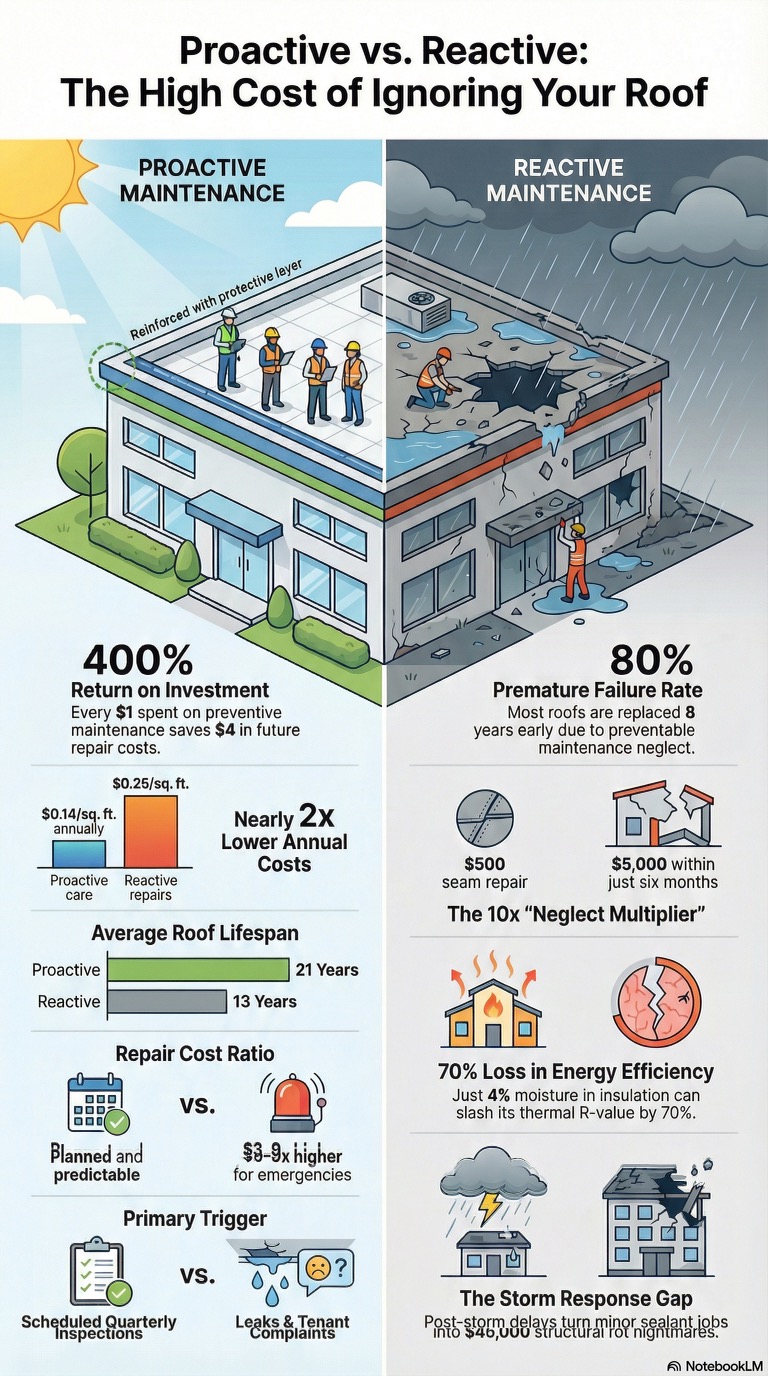
By the time a ceiling tile browns, insulation sags, or a leak appears in a hallway, the water has usually been traveling through the roof assembly for months — sometimes years. Membrane roofing systems (TPO, EPDM, modified bitumen, built-up roofing) are designed to shed water, but once a seam, flashing detail, penetration, or fastener fails, moisture migrates laterally beneath the surface. It saturates insulation board, degrades the roof deck, and accelerates corrosion — all while the top surface looks completely normal to the naked eye.

This is a challenge we see constantly with facility leaders here in Missouri: you cannot manage what you cannot see. Traditional roof inspections rely on visual walkovers, moisture meters at spot checks, or destructive core cuts. All three have real limitations — they’re slow, subjective, and only sample a fraction of the roof’s total area. A 100,000 square foot roof might get a dozen core samples. That leaves the other 99% a guessing game.
Add in the swings of a St. Louis climate — humid summers, freeze-thaw winters, and severe spring storm seasons — and roofs across the metro take a beating that makes hidden moisture even more likely to go unnoticed until it’s a five- or six-figure problem.

Infrared thermography closes that gap.

How Thermal Infrared Roof Moisture Detection Works

The science is straightforward, even though the equipment is sophisticated.

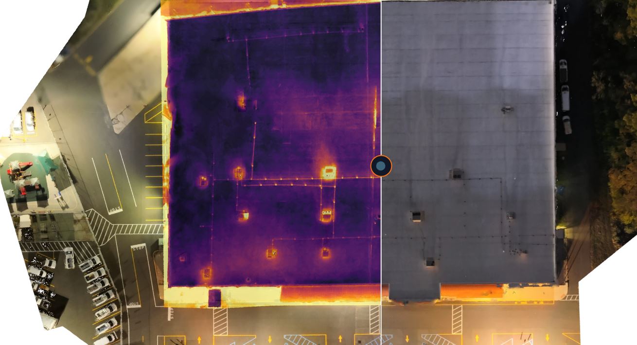
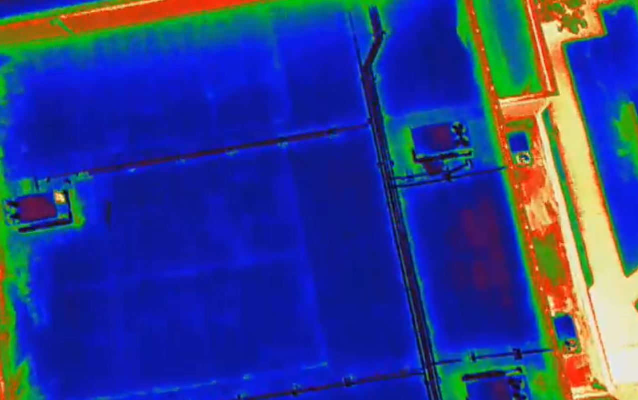
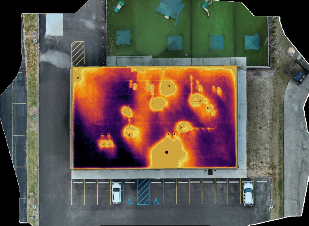
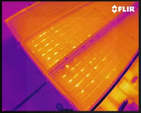
Materials absorb, retain, and release heat at different rates. Dry insulation and dry roofing materials heat up during the day and cool down relatively quickly after sunset. Wet insulation, however, has a much higher thermal mass — it absorbs and holds heat longer. When we fly a FLIR (Forward Looking Infrared) thermal sensor over a roof in the hours after sunset, wet areas beneath the membrane still show measurably warmer than the surrounding dry material, because they’re releasing stored heat at a slower rate. Those temperature differentials appear on the radiometric image as clearly defined “hot spots” that correspond almost exactly to subsurface moisture intrusion.

A few conditions matter for accuracy, and this is where an experienced local crew makes the difference between a useful report and a misleading one:

  • Solar loading during the day to charge the roof with heat
  • A sufficient temperature differential between day and night (generally a minimum swing of 18–20°F)
  • Clear skies with minimal wind during the flight window, since cloud cover and wind flatten the thermal signature
  • Dry roof surface at the time of the flight — rain or heavy dew within 24 hours can produce false readings
  • Correct emissivity settings and radiometric calibration for the specific membrane and insulation type

This is why thermal roof scans are typically flown in the early evening, in specific weather windows, by pilots and thermographers who understand roofing systems — not just drone operation. Anyone can fly a drone with a thermal camera attached. Producing a defensible, accurate moisture map requires understanding building science, and knowing how to work around St. Louis’s often unpredictable weather patterns to catch the right conditions.
Why Drones Instead of Handheld or Walked Infrared?

Handheld thermal imaging and walked infrared surveys have been used in the roofing industry for decades, and they still have a place. But drone-based thermal capture solves several practical problems at once:

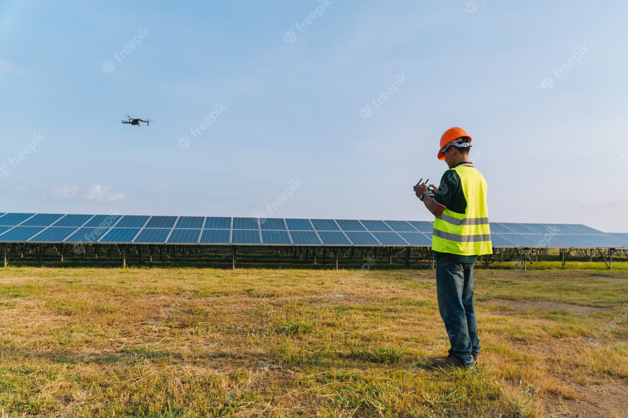
Complete, consistent coverage. A drone flies a programmed grid pattern at a fixed altitude and overlap percentage, capturing the entire roof surface with uniform image quality — no missed sections, no operator fatigue, no walking on a roof that may already be compromised.

Safety. Aging roofs, especially over occupied healthcare or manufacturing space, can present real fall and structural hazards. An aerial platform removes personnel from the roof surface entirely during the diagnostic phase.

Speed and minimal disruption. A large commercial or campus roof that would take a walked survey crew a full day or more can often be captured aerially in a fraction of the time, with no foot traffic on the membrane and no interruption to building operations.

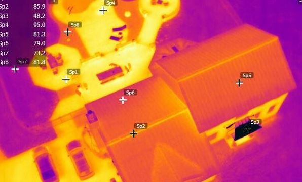
Georeferenced, radiometric data. Every pixel in a properly captured thermal image carries an actual temperature value, and every image is tied to precise GPS coordinates. That means findings aren’t just “this area looks warm” — they’re quantifiable, mappable, and repeatable.
From Flight to Findings: What the Deliverable Actually Looks Like

A thermal drone inspection isn’t just a folder of infrared photos. At St Louis Video Studio, our process is built to produce a document facility leaders can actually use — and, when necessary, defend in front of a roofing contractor, an insurance adjuster, or a school board.

Our typical deliverable includes:

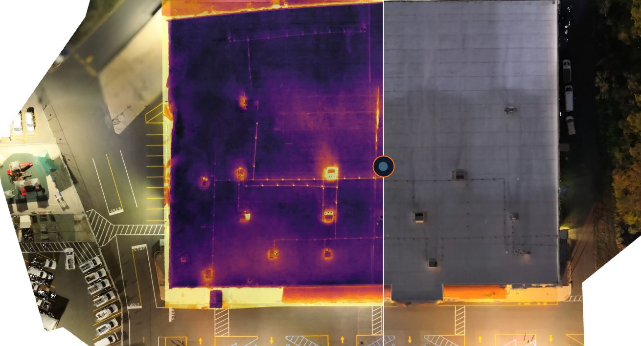
  1. Orthomosaic thermal map — all individual thermal images stitched into a single, scaled overhead map of the entire roof, so moisture patterns can be viewed in context rather than as isolated frames.
  2. Overlaid visual (RGB) imagery — a matching high-resolution optical map so anomalies can be cross-referenced against physical roof features like drains, curbs, HVAC units, and seams.
  3. Radiometric data annotations — actual temperature values and delta readings at flagged anomaly zones, not just color gradients.
  4. Timestamped, geotagged records — every flight, every image, and every flagged zone is dated and located, creating a baseline that can be compared against future inspections to track whether a problem area is stable, growing, or has been successfully repaired.
  5. Summary report with prioritized findings — anomalies ranked by severity and estimated square footage affected, giving facility teams a basis for budgeting targeted repairs instead of full roof replacement.

That last point is where the real financial value lives. Roofing contractors often recommend replacement when they can’t isolate the extent of the damage. A precise moisture map lets a facility director instead pursue targeted repair of the actual wet areas, extending the life of an otherwise sound roof system by years and avoiding capital expenditure that wasn’t necessary.

Who This Serves — and Why It Matters for Each Sector

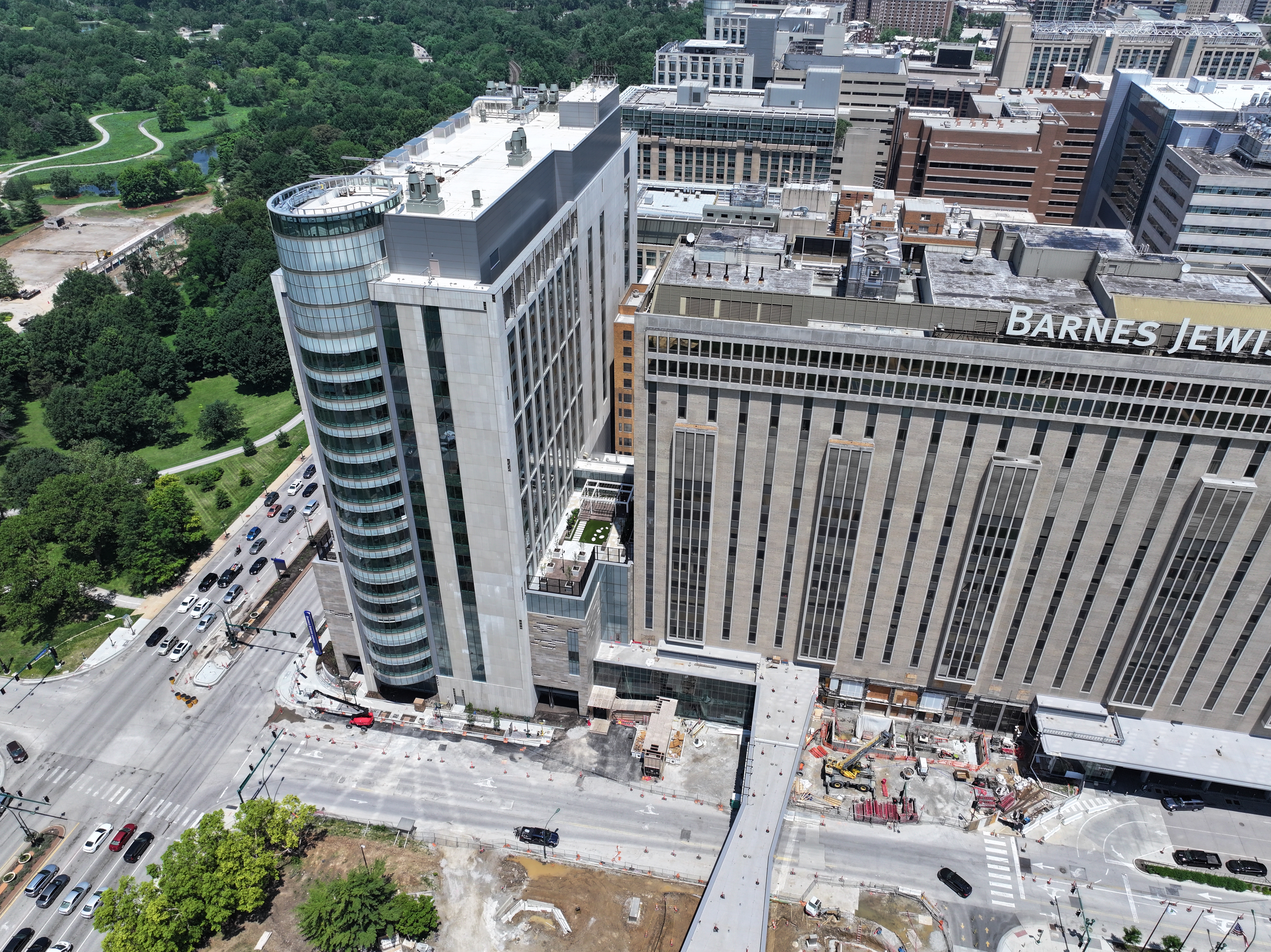
Schools and school districts. Roofs over classrooms and gymnasiums are often large, aging, and difficult to budget for on a reactive basis. A district-wide thermal survey gives facilities departments a prioritized, data-backed capital plan instead of guessing which building needs attention first — and gives them documentation to support bond requests or emergency funding.

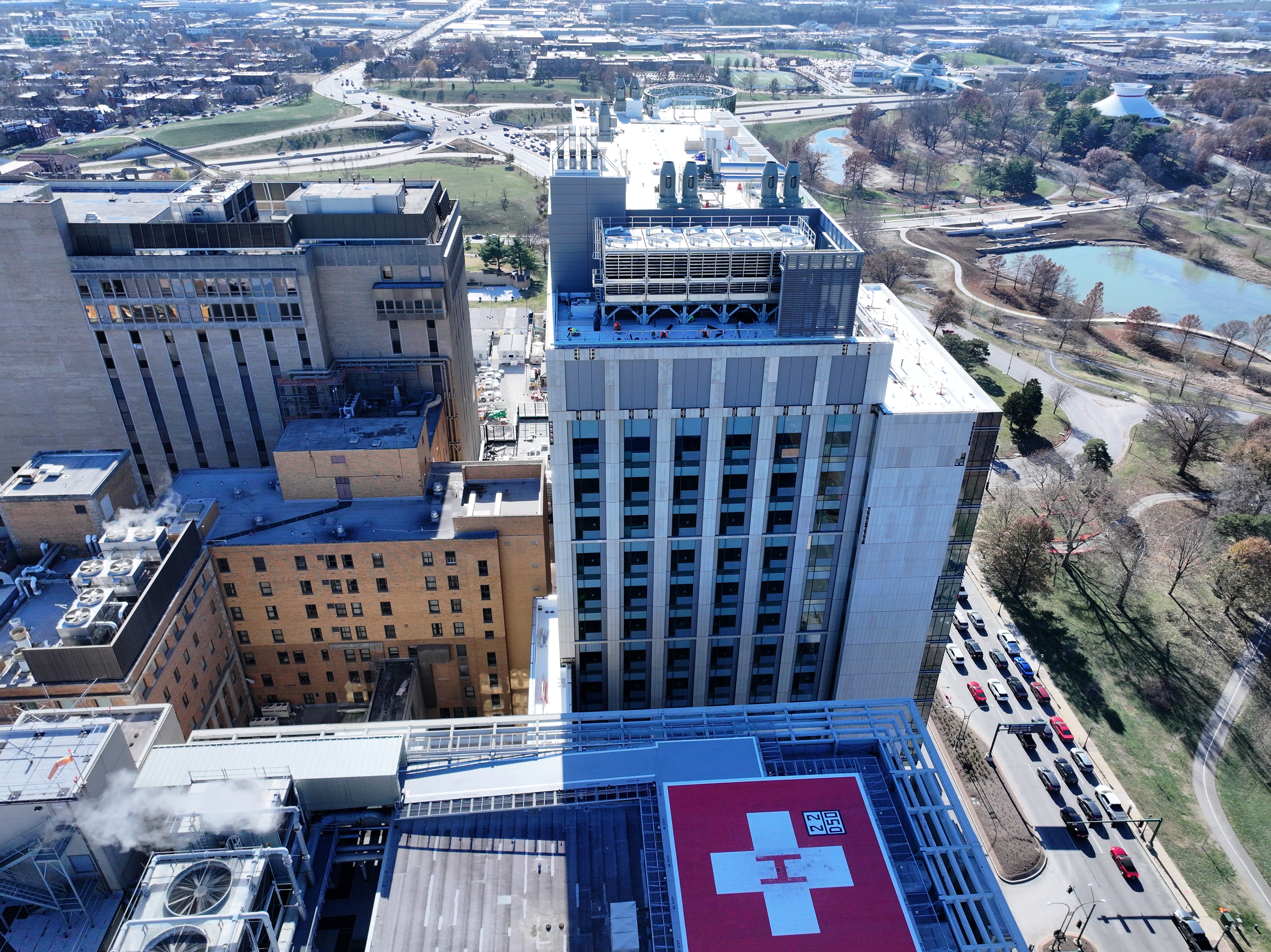
Healthcare facilities. Moisture intrusion above patient care areas, surgical suites, or sensitive equipment isn’t just a maintenance issue — it’s an infection control and compliance issue. Defensible, timestamped documentation supports Joint Commission readiness and helps facilities teams act before a leak becomes a life-safety event.

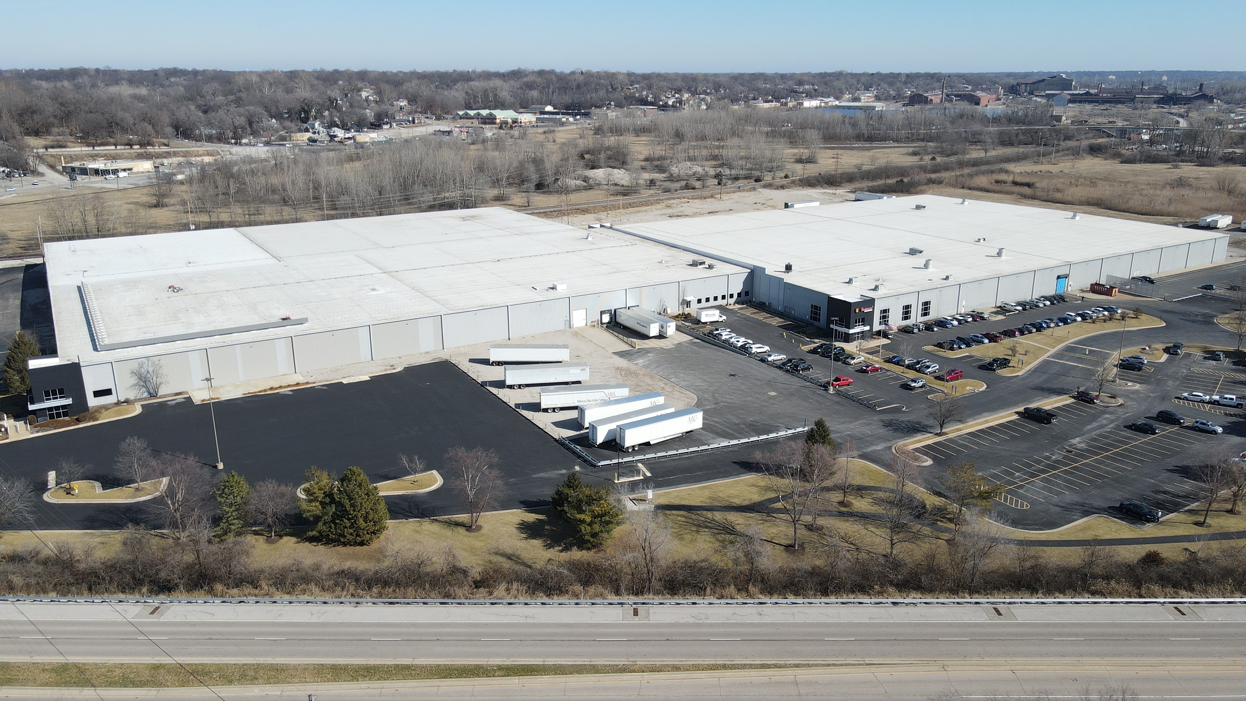
Manufacturers. Water intrusion above production floors threatens equipment, inventory, and uptime. For facilities running continuous operations, an aerial thermal survey can be scheduled around production hours with zero disruption to the line.

Commercial portfolios and property managers. For owners managing multiple properties across St. Louis and the surrounding metro, a standardized thermal inspection program creates a consistent, comparable dataset across the entire portfolio — supporting due diligence in acquisitions, reserve fund planning, and warranty claims with roofing manufacturers.
Beyond the Roof: LIDAR and Cinematography

Thermal roof inspection is one piece of a broader aerial data and creative practice at St Louis Video Studio.

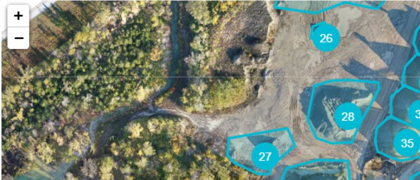
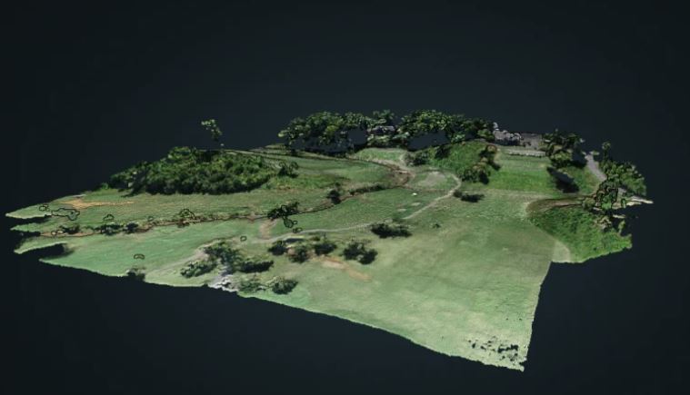
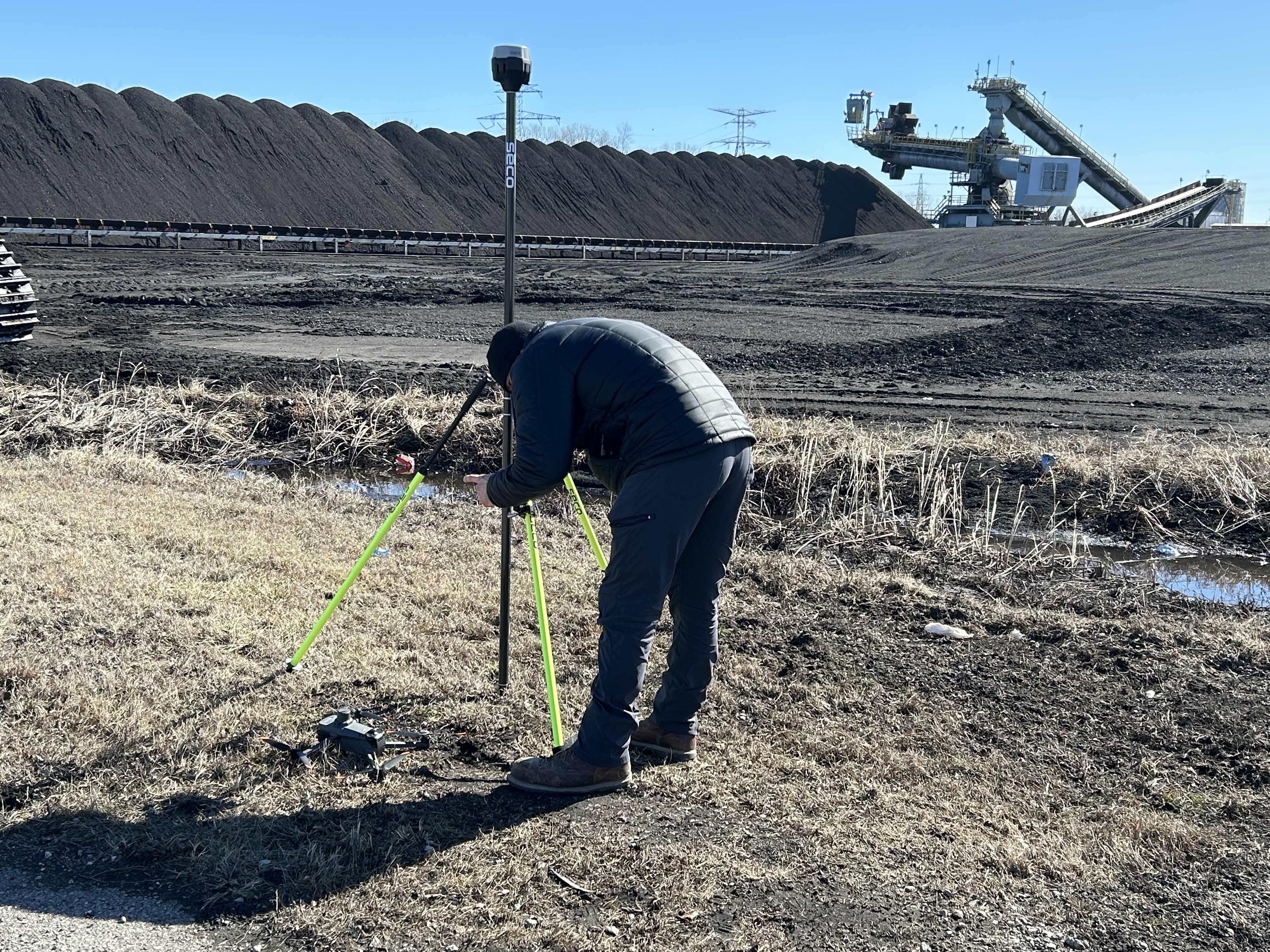
Drone LIDAR extends this same data-driven approach into precise 3D mapping — capturing accurate elevation data, drainage slopes, structural topography, and volumetric measurements for facilities, construction progress, and site planning. Where thermal imaging tells you where moisture is, LIDAR can help confirm why — revealing ponding areas, slope deficiencies, and structural deformation that contribute to water intrusion in the first place.

Cinematography services round out our aerial capability for organizations that also need high-production-value video and photography — for marketing, donor and board presentations, campus tours, or documenting major construction and renovation projects. The same FAA-certified pilots and equipment used for technical inspection work are equally capable of producing polished, broadcast-quality aerial footage for St. Louis area organizations.
314-913-5626

stlouisvideostudio@gmail.com

Unknown's avatar

Why Licensed Drone Pilots Matter for Commercial Projects

For businesses, agencies, municipalities, contractors, developers, and organizations, hiring a licensed drone pilot is not just a technical preference. It is a professional requirement.

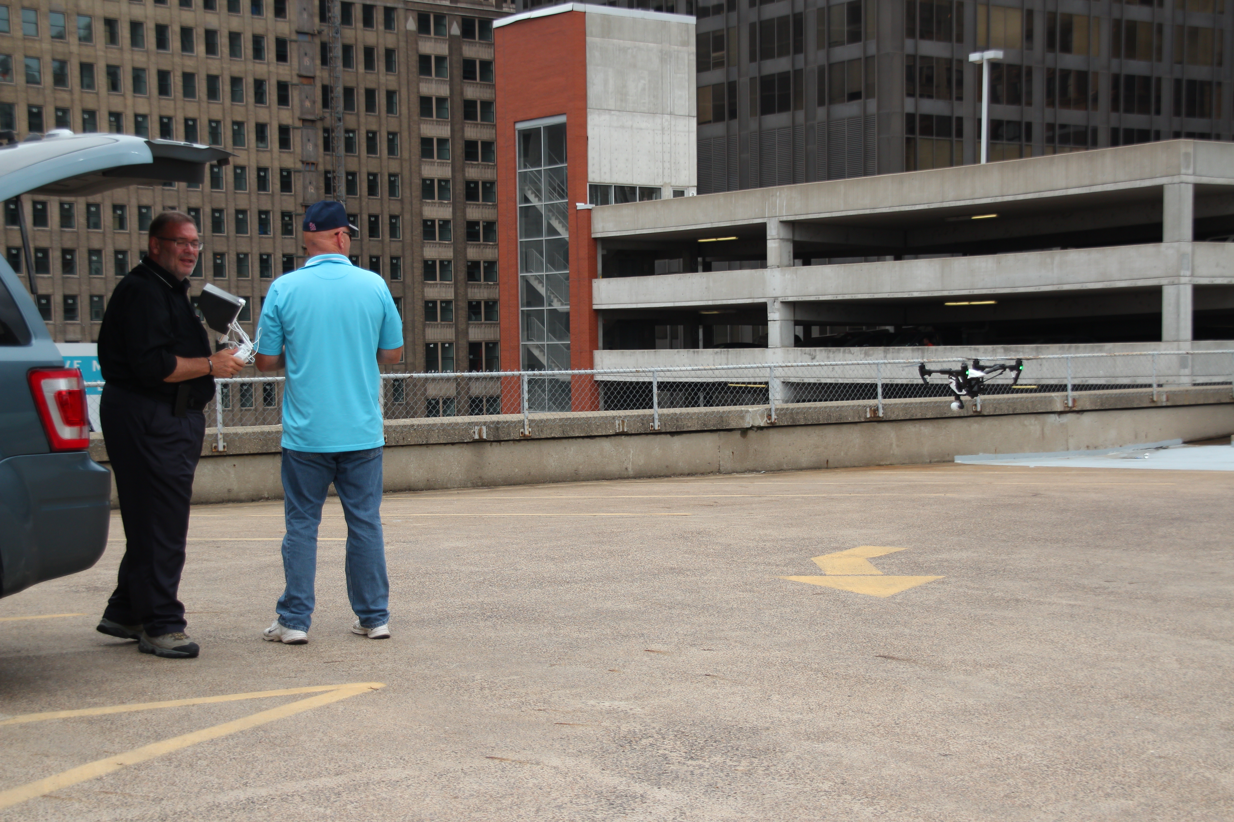
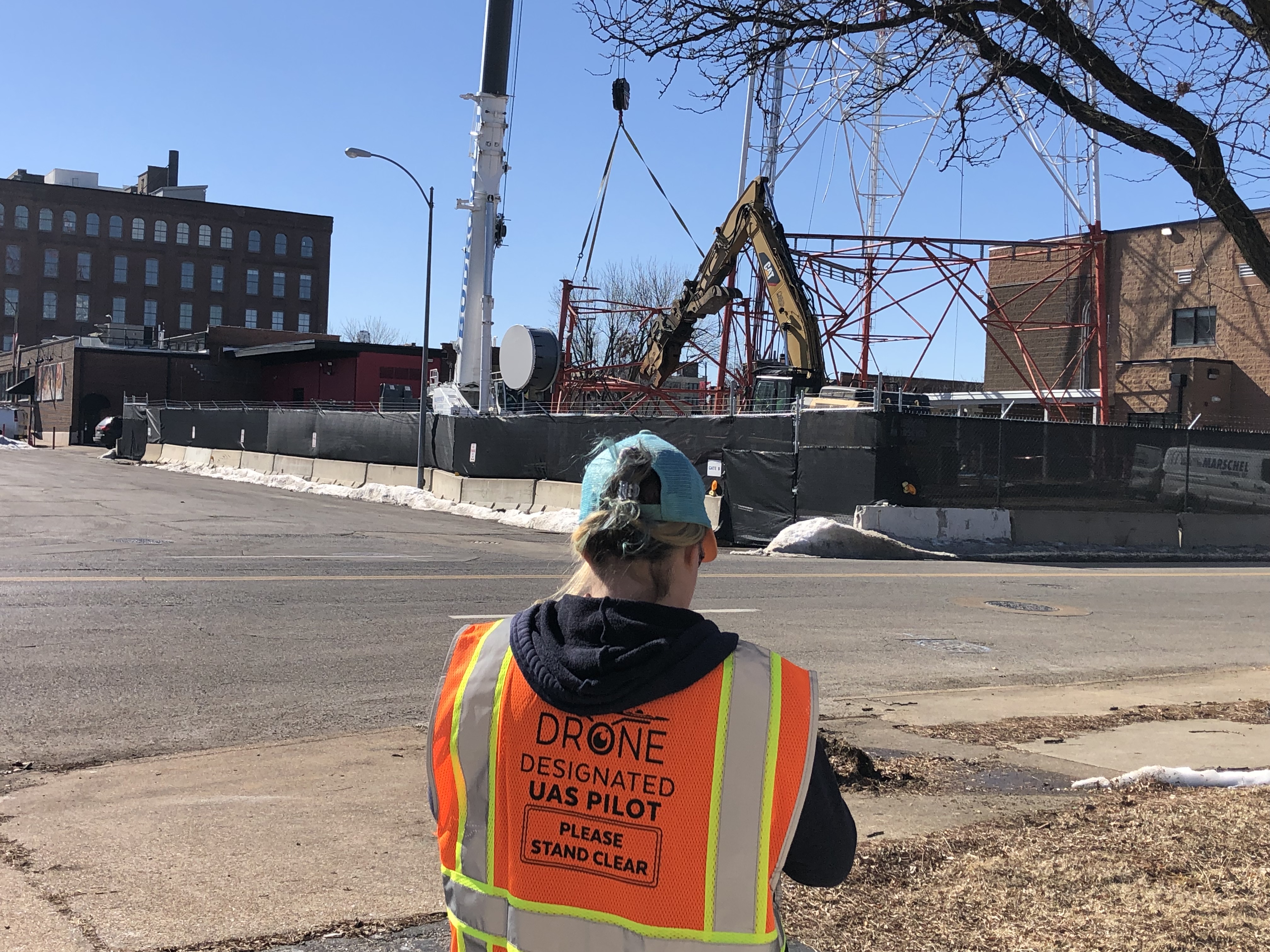
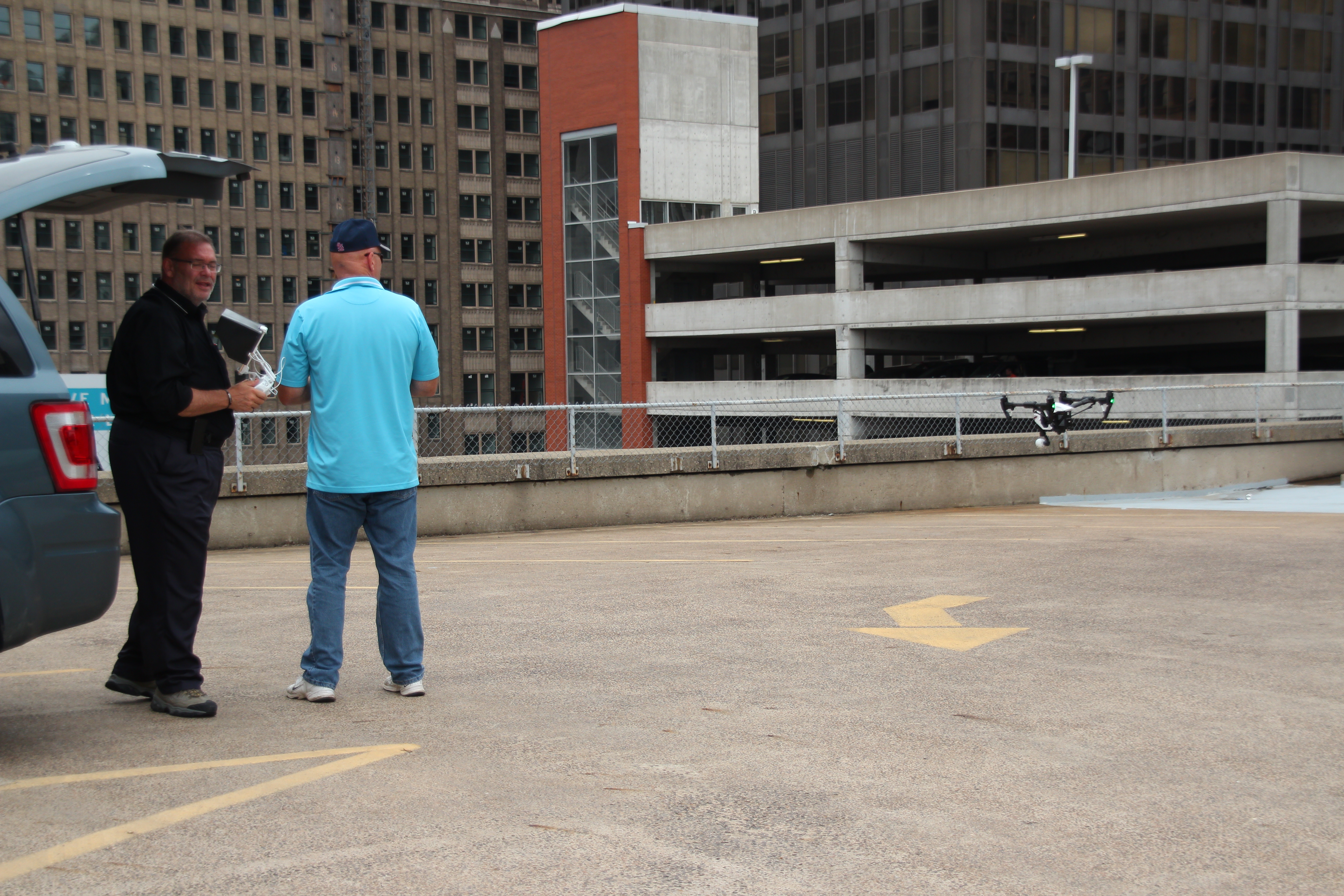
Commercial drone operations involve airspace rules, FAA requirements, weather evaluation, flight restrictions, property considerations, safety planning, and liability concerns. A licensed drone pilot understands how to evaluate whether a flight can be performed safely and legally. That includes checking airspace, assessing site conditions, identifying obstacles, maintaining visual line of sight, understanding altitude restrictions, and making sound decisions before and during flight.

An experienced drone pilot also knows when not to fly. Wind, rain, low visibility, nearby airports, power lines, heavy pedestrian traffic, reflective surfaces, active construction equipment, and tight urban environments can all affect the safety and success of a drone operation.

For decision makers, this matters because drone footage is often captured around valuable property, active business operations, employees, customers, vehicles, equipment, and public spaces. A professional pilot reduces risk while increasing the chances of capturing footage that is technically clean, visually strong, and usable in the final production.

The Importance of Insurance and Professional Accountability

Insurance is another key consideration when selecting a drone production provider. Commercial drone work can involve flying near buildings, rooftops, signage, vehicles, industrial equipment, construction zones, event venues, and large groups of people. Even when flights are carefully planned, professional accountability matters.

An insured drone production company gives businesses and agencies greater confidence that the project is being handled responsibly. It also reflects a professional approach to risk management. Drone work should not be treated casually, especially when the footage is being created for a business, institution, construction firm, real estate developer, healthcare organization, manufacturer, school, or public-facing campaign.

St Louis Video Studio understands that commercial clients need more than impressive-looking aerial shots. They need a production partner who respects safety, protects the client’s reputation, and understands the professional standards required on business and agency assignments.

Simple Aerial Projects Still Require Experience

Many drone projects appear simple on the surface. A company may need an exterior shot of its building. A real estate team may need aerial views of a property. A contractor may need progress documentation. A marketing department may want a few aerial clips to add production value to a corporate video.

Even these straightforward assignments benefit from experience.

A skilled drone crew considers the best time of day, sun angle, shadows, wind direction, property access, flight path, background distractions, camera movement, framing, and how the footage will be edited. A simple exterior shot can be elevated by using the right approach, speed, altitude, and reveal. A building can look more substantial with the correct angle. A property can be made easier to understand with a thoughtful combination of wide shots, approaches, orbits, and detail views.

The goal is not to fly randomly and hope for something attractive. The goal is to capture purposeful footage that supports the message.

For example, an aerial establishing shot may be used in a website video, a social media campaign, a sales presentation, a recruiting piece, a trade show loop, or a corporate overview. When the footage is captured professionally from the beginning, it can be reused across multiple platforms and campaigns.

Advanced Drone Projects Require Technical Skill and Planning

Some aerial assignments require more than standard drone footage. Advanced projects may involve complex flight environments, technical imaging, data capture, mapping, inspection support, or specialized production techniques.

These projects can include:

  • Indoor FPV drone fly-throughs
  • Infrared thermal drone imaging
  • Orthomosaic mapping
  • LiDAR capture
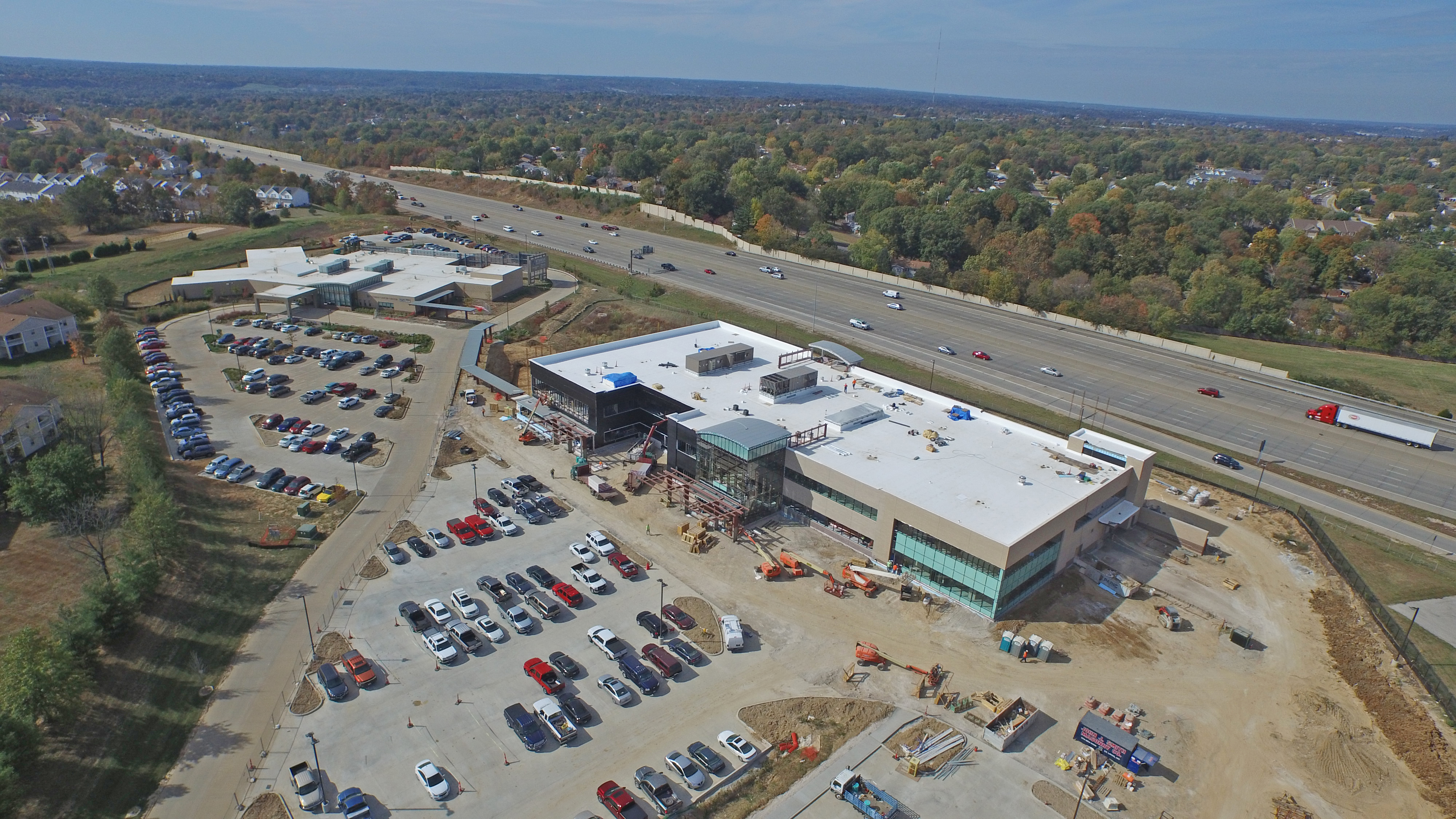
  • Construction progress documentation
  • Commercial roof inspection support
  • Industrial site imaging
  • Large property surveys
  • Facility overview videos
  • Event aerial coverage
  • Real estate and development documentation
  • Campus, hospital, school, and corporate location videos
  • B-roll acquisition for larger productions

Advanced aerial projects demand a production team that understands both drone operation and the broader purpose of the imagery. The footage may need to support marketing, planning, documentation, safety review, engineering coordination, stakeholder updates, investor presentations, recruitment, public relations, or internal communications.

This is where St Louis Video Studio’s full-service production experience becomes valuable. We understand how aerial visuals fit into a larger communication strategy.

314-913-5626

stlouisvideostudio@gmail.com

Unknown's avatar

Leveraging LIDAR and Thermal Drone Technology for Business Insights in St. Louis

As decision-makers in photography, marketing, and video production, you are constantly seeking innovative tools to gain a competitive edge and make more informed strategic choices. In today’s data-driven landscape, advanced drone technology, specifically equipped with LIDAR and Thermal imaging sensors, has emerged as a game-changer across numerous industries, providing unparalleled visual and structural information.

LIDAR Drones: Creating Precise 3D Worlds

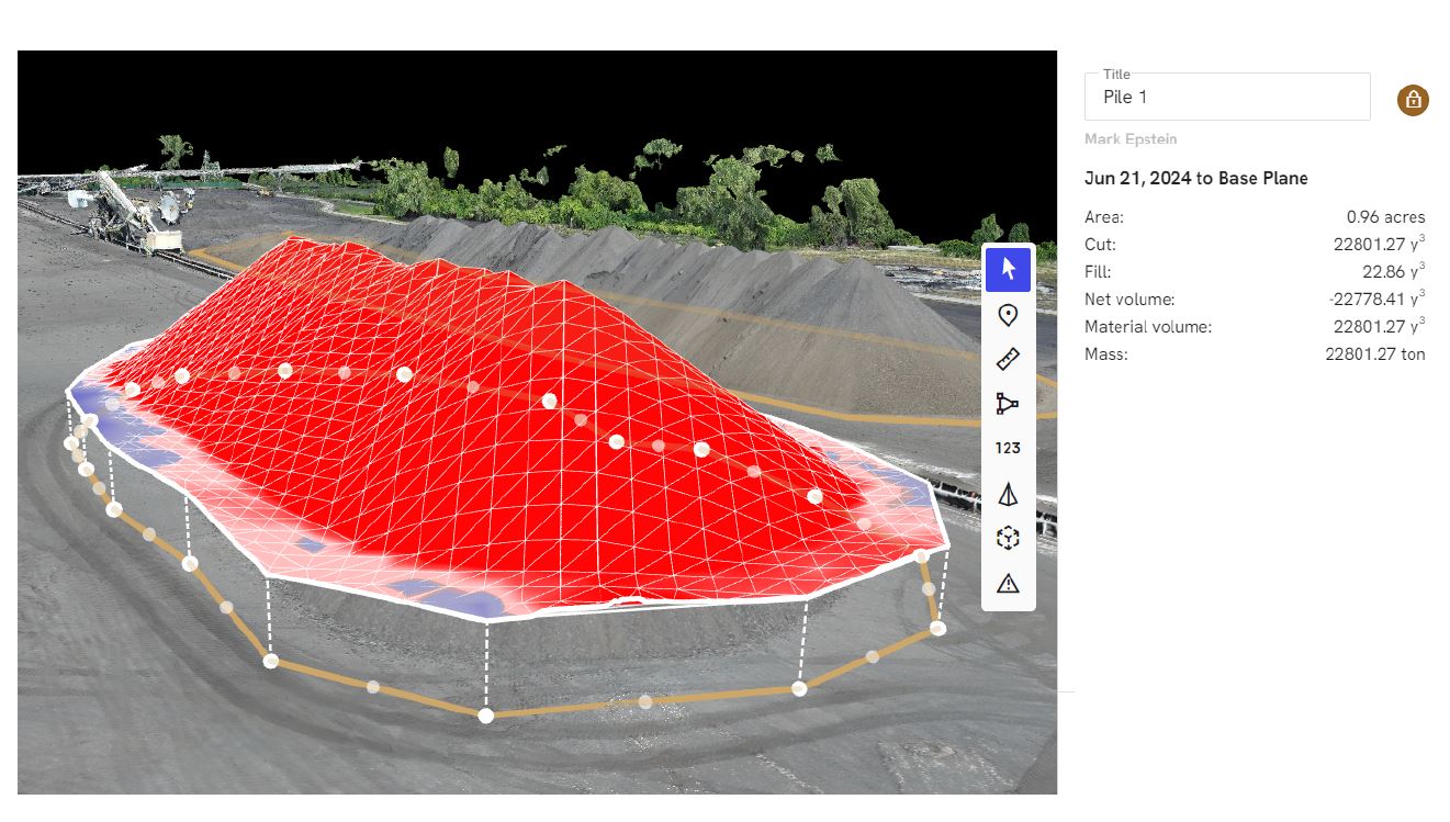
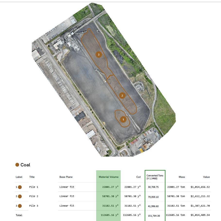
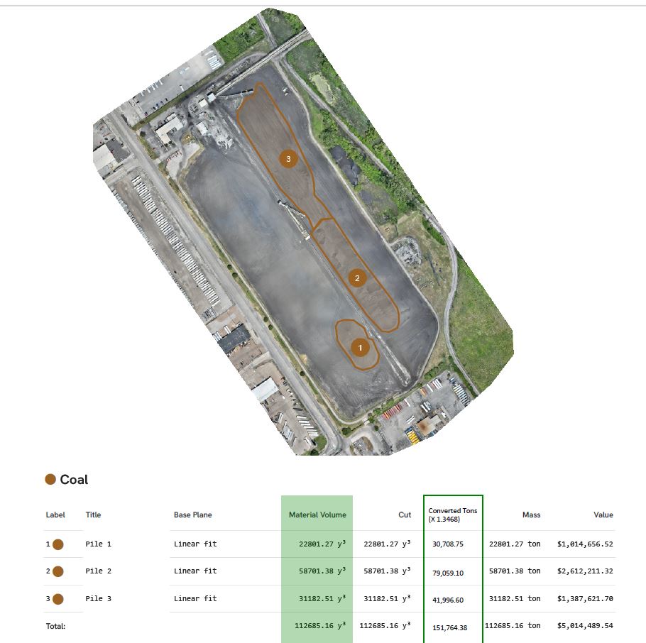
LIDAR, an acronym for Light Detection and Ranging, uses rapid laser pulses to map the environment in three dimensions. While conventional aerial photography captures a visual representation, LIDAR creates a dense “point cloud” that accurately measures distances and shapes. For businesses, this translates to incredibly precise topographic maps, detailed 3D models of infrastructure, and accurate volumetric calculations for stockpiles or construction materials.

Imagine being able to survey vast or challenging terrains in a fraction of the time and cost compared to traditional ground methods. LIDAR can penetrate vegetation, revealing the true ground surface, which is invaluable for pre-construction planning, flood modeling, and forestry management. For infrastructure maintenance, LIDAR scans can detect subtle structural changes over time, allowing for proactive repairs and enhanced safety protocols.

Thermal Imaging Drones: Seeing Heat Signatures

Complementing LIDAR’s structural data, thermal imaging sensors on drones detect heat radiation, not just visible light. This technology visualizes temperature variations across surfaces, revealing hidden issues invisible to the naked eye. Businesses use thermal drones for energy audits, identifying insulation voids, moisture penetration in roofing, or heat loss from buildings.

In industrial settings, thermal inspections can pinpoint overheating electrical components, leaking pipelines, or failing mechanical systems, preventing costly downtime and potential hazards. Thermal drones are also critical for solar panel maintenance, quickly identifying malfunctioning cells. Beyond inspections, they enhance security operations and search and rescue efforts by detecting heat signatures in diverse environments.

Integrating Data for Actionable Insights

The true power lies in the synergistic use of LIDAR and thermal data. Imagine overlaying thermal temperature information onto a precise 3D model generated by LIDAR. This comprehensive perspective enables you to not only visualize the structure but also immediately understand its thermal characteristics. This combined data empowers decision-makers to optimize energy usage, prioritize maintenance, ensure safety compliance, and streamline operations with unprecedented clarity.

St. Louis Video Studio: Your Expert Partner for Advanced Drone Solutions

Unlocking these sophisticated insights requires more than just advanced technology; it demands a seasoned partner with deep expertise, the right equipment, and a creative, capable crew. As a long-standing fixture in the St. Louis production community since 1982, St. Louis Video Studio has evolved alongside technology, positioning itself as a premier full-service professional commercial photography and video production company.

We understand successful image acquisition involves more than just launching a drone. It requires experienced pilots, high-resolution sensors, and meticulous planning to ensure accurate data capture. Our licensed drone operators (including specialized drone services for St Louis Video Studio) have worked with many businesses, marketing firms, and creative agencies in the St. Louis area, delivering high-impact visual data and compelling content across diverse applications. Our capabilities even extend indoors, as we can fly our specialized drones indoors to capture unique perspectives within large facilities, warehouses, or even during complex indoor events, providing invaluable data and stunning visuals where conventional access is limited.

Beyond our aerial expertise, we provide full-service studio and location video and photography. Our private studio lighting and visual setup is perfect for small productions and interview scenes, meticulously supporting every aspect of your production—from setting up a private, custom interview studio to supplying professional sound and camera operators, as well as providing the right equipment—ensuring your next video production is seamless and successful. Our studio is large enough to incorporate props to round out your set, should your vision require more elaborate staging.

Data acquisition is only part of the equation. We offer comprehensive editing, post-production, and full-service media capabilities, ensuring that the raw imagery and information are transformed into compelling narratives, clear visual guides, or precise actionable reports. We use the latest in Artificial Intelligence for all our media services, enhancing efficiency and visual quality throughout the entire process. Our creative crew is well-versed in handling diverse file types and styles of media and proficient with accompanying software, guaranteeing seamless integration with your existing platforms or marketing initiatives.

We excel not only at creating new, high-impact content but also in customizing productions for diverse media requirements and skillfully repurposing your existing photography and video branding to ensure your visual identity consistently gains more traction across all channels. Our dedication to your success extends to supporting every aspect of your production, from the initial concept to the final, polished deliverable.

So, whether you’re looking to gain critical structural data, improve energy efficiency, enhance safety protocols, or simply elevate your brand through sophisticated visuals captured from above (or even indoors!), St. Louis Video Studio has the experience (since 1982), technology, and dedicated crew to make it happen successfully. Contact us today to discuss how LIDAR and thermal drone technology, backed by our comprehensive professional services, can empower your next project.

314-913-5626

stlouisvideostudio@gmail.com

Unknown's avatar

How Drone Inspections Expose Building Heat Loss Before It Gets Expensive

Energy waste rarely announces itself with a flashing red light.
Most of the time, it slips out quietly—through a failing roof membrane, leaky windows, uninsulated walls, or aging mechanical systems. By the time a problem becomes visible inside the building, you’ve often already paid for it several times over in wasted energy, moisture damage, and emergency repairs.

Drone-based thermal inspections change that equation. They give you a fast, safe, and visual way to see exactly where your building is losing heat—across an entire facility or campus—without scaffolding, lifts, or guesswork.

For facility managers, building owners, and the marketing and communications teams who support them, this kind of visual data isn’t only a maintenance tool. It’s also powerful storytelling and documentation: proof of due diligence, sustainability efforts, and capital improvement ROI.

Let’s break down how drone inspections help you “fix” building heat loss—practically, safely, and in a way that can be clearly communicated to stakeholders.


What “Building Heat Loss” Really Looks Like in the Real World

Heat loss isn’t a single problem; it’s a cluster of related issues that show up in different ways:

  • Roofing failures
    • Wet or saturated insulation under a membrane
    • Seams and penetrations where warm air escapes
    • Ponding water that leads to long-term moisture and structural issues
  • Wall and façade problems
    • Thermal bridging at structural elements
    • Missing or compromised insulation in panels or cavities
    • Failing joints around expansion gaps and cladding
  • Windows, doors, and openings
    • Leaky curtain walls and storefront systems
    • Gaps around overhead doors in loading docks and warehouses
    • Aging weatherstripping that no longer seals
  • Mechanical and utility losses
    • Steam line leaks
    • Inefficient rooftop units (RTUs) running hot
    • Poorly insulated piping and ductwork

All of these issues show up as temperature anomalies—areas that are warmer or colder than they should be relative to surrounding surfaces. Thermal cameras mounted on drones capture this delta and translate it into clear, actionable visuals.


Why Traditional Inspections Miss So Much

Conventional building envelope inspections rely heavily on:

  • Walking the roof with a handheld thermal camera
  • Lift-based checks of façades
  • Visual inspections from the ground
  • Trial-and-error destructive testing

Those methods can work—but they’re:

  • Slow and labor-heavy
  • Limited in coverage (you see only what you can safely reach)
  • Dependent on the inspector’s vantage point and experience
  • Potentially disruptive to building operations

In large facilities—corporate campuses, industrial plants, logistics hubs, healthcare complexes—it’s easy for problem areas to stay hidden for years simply because no one can see them safely, quickly, and comprehensively.

Drone inspections step over those limitations.


How Drone-Based Thermal Inspections Work

A modern building heat-loss drone survey typically includes two data layers:

  1. Thermal (infrared) imagery – to show temperature anomalies
  2. High-resolution visual imagery – to document physical conditions

Here’s what the process looks like when it’s done professionally:

1. Pre-Planning

  • Review site constraints (airspace, nearby airports, local restrictions)
  • Map building footprints, roof levels, obstructions, and critical areas
  • Coordinate with building management for access, timing, and safety

2. Optimal Timing and Conditions

Thermal inspections depend on contrasts. The best results typically come when:

  • There’s a clear difference between indoor and outdoor temperatures
  • The building has gone through a heating or cooling cycle
  • Direct sunlight and reflective surfaces are managed to avoid false positives

An experienced drone crew plans flight schedules to maximize this contrast and minimize noise in the data.

3. Flight and Data Capture

Using specialized drones equipped with radiometric thermal sensors, the crew:

  • Flies precise grid patterns over roofs and façades
  • Captures overlapping thermal stills and/or video
  • Collects matching high-res visual imagery for context

With the right gear and pilots, an inspection that would take days on lifts can often be captured in a fraction of the time—with no one leaving the ground.

4. Analysis and Interpretation

Raw thermal data is only half the job. The real value comes from:

  • Comparing thermal images with visual imagery to understand what’s happening at each anomaly (e.g., seam failure, wet insulation, missing insulation, mechanical issue)
  • Creating maps and reports that align anomalies with real-world locations and roof or building drawings
  • Flagging priority areas by severity, risk, and likely cause

This is where pairing commercial drone pilots with a seasoned imaging and post-production team pays off. You’re not just getting “cool pictures”—you’re getting usable intelligence.


Where Drone Thermal Inspections Deliver the Biggest Wins

1. Commercial Roofs

Flat and low-slope roofs are a perfect fit for drone thermography. Aerial thermal imagery can reveal:

  • Wet or saturated insulation
  • Failing seams, flashings, and penetrations
  • Heat loss around HVAC curbs, vents, and skylights

Instead of guessing where to core sample or cut, you target the exact spots that show anomalies—reducing destructive testing and focusing repair budgets where they matter.

2. Building Envelopes and Façades

From high-rise office towers to big-box retail, drones can scan façades quickly and safely to detect:

  • Missing or poorly installed insulation
  • Thermal bridging at structural elements and anchors
  • Air leakage around windows, doors, and façade transitions

For owners, this is invaluable evidence when evaluating contractor work, planning façade upgrades, or developing long-term capital budgets.

3. Industrial and Utility Infrastructure

Drone-based thermal imaging is also effective for:

  • Steam tunnels and pipe runs
  • Heat exchangers and process equipment
  • Mechanical rooms and rooftop units (when accessible to line-of-sight)

Being able to capture both thermal and visual data from elevated angles gives maintenance teams an immediate short list of what to address first.


Turning Technical Data into Clear Visual Communication

You’re not just fixing heat loss; you’re also justifying budgets, demonstrating ESG progress, and communicating risk and ROI to non-technical audiences.

That’s where expert video and photography production comes in. Thoughtful post-production can transform your drone capture into:

  • Executive-ready presentations
    • Before/after visuals of problem areas and completed repairs
    • Simple overlays that show thermal anomalies alongside the visible image
    • Callouts and annotations explaining what each hotspot means
  • Board and investor updates
    • Short, narrated explainer videos that walk through issues, solutions, and projected savings
    • Visual documentation of capital improvements tied to sustainability and resilience goals
  • Marketing and ESG storytelling
    • Branded micro-videos and stills demonstrating your commitment to energy efficiency
    • Visual proof that your organization is proactive about infrastructure health, not reactive

When drone and thermal inspections are paired with a professional studio and post-production team, you’re not just checking boxes—you’re creating a visual asset library that supports operations, compliance, and brand.


Planning a Drone Inspection Program That Actually Pays Off

To get maximum value from building heat-loss inspections, treat them as a structured program, not a one-off event.

Consider:

  1. Baseline Survey
    • Capture current conditions across roofs, façades, and key mechanical areas
    • Identify and rank anomalies by risk and cost impact
  2. Targeted Repairs and Upgrades
    • Use the visuals to guide contractors directly to problem zones
    • Prioritize “quick win” fixes with strong ROI
  3. Follow-Up and Verification Flights
    • Confirm completed repairs actually resolved the thermal issues
    • Build a “before and after” visual record for internal and external stakeholders
  4. Ongoing Monitoring
    • Schedule periodic inspections (annually or after major weather events)
    • Track trends over time to anticipate failures before they become critical

When your inspection assets are captured and processed by an experienced imaging partner, each year’s data layers cleanly onto the last. Over time, you build a visual history of the building’s performance that’s hard to dispute—and incredibly valuable.


Why Professional Production Quality Matters

Anyone can buy a drone and a thermal camera. Very few can:

  • Fly safely and legally in complex environments
  • Capture usable, consistent images and video that align with inspection goals
  • Color-grade, annotate, and edit that footage into a coherent story for decision makers
  • Deliver footage and stills in formats that your engineers, contractors, marketing team, and executives can all use without frustration

That’s the gap a dedicated video studio fills—translating raw technical capture into polished, clear, and versatile visual assets.


Partner with St. Louis Video Studio for Drone Heat-Loss Inspections

St. Louis Video Studio is an experienced, full-service professional commercial photography and video production company with the right equipment and creative crew experience for successful image acquisition—on the ground and in the air.

We offer full-service studio and location video and photography, as well as editing, post-production and licensed drone pilots. St. Louis Video Studio can customize your productions for a wide range of media requirements, from technical inspection documentation to executive briefings and marketing campaigns.

Repurposing your photography and video branding to gain more traction is another specialty. We are well-versed in all file types, styles of media and accompanying software, and we use the latest in Artificial Intelligence for all our media services—from smart noise reduction and image enhancement to AI-assisted editing and content versioning.

Our private studio lighting and visual setup is perfect for small productions and interview scenes, and our studio is large enough to incorporate props to round out your set. We support every aspect of your production—from setting up a private, custom interview studio to supplying professional sound and camera operators, as well as providing the right equipment—ensuring your next video production is seamless and successful.

For inspections that demand unique perspectives, we can even fly our specialized drones indoors where appropriate and safe, capturing views that traditional methods simply cannot reach.

As a full-service video and photography production corporation since 1982, St. Louis Video Studio has worked with many businesses, marketing firms and creative agencies in the St. Louis area for their marketing photography and video. Whether you’re documenting building heat loss, showcasing repairs, or telling a broader story about your organization’s commitment to efficiency and sustainability, we’re ready to help you capture it—and communicate it—clearly.

314-913-5626

stlouisvideostudio@gmail.com